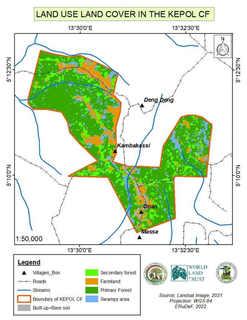
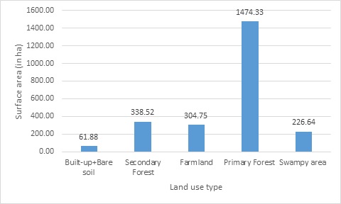
Ground truthing works recently conducted by ERuDeF in the KEPOL Community Forest situated in the Deng Deng National Park-Belabo Council Forest Conservation Corridor has revealed that nine land use types are found in the community forest. These land use include primary forest (1474.33 ha), Secondary Forest (338.52 ha), Farmland (304.75 ha), Swampy area (226.64 ha) and Built-up and Bare soil (61.88 ha).
According the GIS Officer of ERuDeF, Mfonkwet Younchahou who took part in the ground truthing, the KEPOL Community Forest is relatively intact because about 75% is still covered by vegetation (primary and secondary forest). The built-up and bare soil area mostly has to do with roads, settlement and electricity transmission line which passes through the community forest. Part of the community forest is being used for agriculture (shifting cultivation). These constitute major threats to the corridor. “if this community forest is conserved, the movement of species from Deng Deng National Park to Forest Management Unit 10-065 thereby preventing inbreeding”, Mfonkwet said.
It should be noted that the KEPOL Community Forest is situated in the East Region, Lom and Djerem Division, Belabo Sub-Division. It is surrounded by the following villages: Deng Deng, Kambo-Cassi, Hona, Mbaki nam and Manssa. It is bordered to the South and East of the Deng Deng National Park, to the West of FMU (Forest Management Unit) 10-065 to the North of the Deng Deng wildlife corridor. The KEPOL community forest covers a surface area of 2406 hectares with well-defined boundaries. Its Provisional Management Agreement was signed in December 2021 by the Minister of Forestry and Wildlife through a Ministerial decision No 0044 of 23 December 2021.
This community forest was created in the framework of the Deng Deng-Belabo Council Forest Conservation Corridor Project funded by World Land Trust. This project seeks preserve quality habitat of 7406ha between the Deng Deng National Park and Belabo Council Forest for the migration of Western Lowland gorillas and other threatened species.


