By Muluh Quinivette
The Western High Plateau of Cameroon is made of numerous mountains amongst which are the Mbapit and the Nkogham mountains. The Mbapit-Nkolgam Mts is found in the Western High Plateau of Cameroon. The Western High Plateau was once heavily forested. However, repeated cutting and burning by human beings have forced the forest back to areas along the waterways and have allowed grasslands to expand into the area. Sudan savanna forms the dominant vegetation and short shrubs and trees that shed their foliage during the dry season as a defence against bush fires and dry weather. Raffia palms grow in the valleys and depressions.

Lake Mfou- Mbapit-Nkolgam Mts
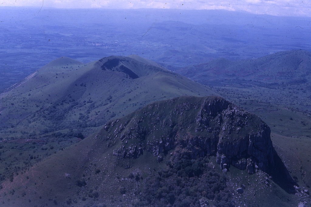
Mount Mbapit is a volcano in Western Cameroon which rises to nearly 2000m above sea level. It is situated in the Noun Division of the West region of Cameroon in between the localities of Foumbot and Foumban. This mountain has one crater lake. Its crater lake is a popular tourist destination. Mount Nkogham has an elevation of 1,523 meters. The Nkogham massif is situated northeast of Nkounden in the Noun Division of the West region of Cameroon. The Mbapit-Nkogham Mountains (MNM) rise at the edge of the Foumbot plain and extend towards the Adamawa plateau.
These mountains constitute one of the sub-watersheds that feed the Mbam River and Sanaga River. The Mbapit-Nkogham Mts watershed is the principal motor of the Noun market (horticulture) gardening. The contribution of Mbapit-Nkogham mountains watershed to the Cameroon water sector is substantial. This watershed drains into the Noun River that contributes to the principal source of the Bamendjin Reservoir that feeds the Edea Power plant which supplies electricity in Cameroon
The Mbapit-Nkogham mountains ecosystem with the presence of endangered species such as Chimpanzees, antelopes, porcupines, gorillas, elephants, hare and red colobus monkeys. This ecosystem has a high degree of endemism. Due to an exaggerated anthropogenic pressure, this biodiversity-rich mountain has almost been completely degraded. Bush fires and deforestation have led to forest cover loss and habitat loss. Biodiversity has been severely reduced, with many of the species going to local extinction. The loss of vegetation cover in this area has led to the decline in the watershed which feeds the Mbam River, the main tributary to the Sanaga River, thereby putting at risk the functioning of Cameroon’s two major hydroelectric plants fed by the Mbam and Sanaga River. The mountain has lost its function as a watershed, and the farms and pastures have gradually lost their productive soils. The degradation of the catchments has led to serious water shortages. Urbanization and intensification of farming have led to soil erosion, food and water contamination, and will result in decreasing yields and reduced incomes. Poverty is also exacerbated and the local communities lack access to social amenities, leading to increased low standards of living.

Mt Mbapit
ERuDeF has a long-term commitment in Western Cameroon to support the conservation of biodiversity and improve the quality of life of the people living in the geographical area. To consolidate its existing interventions in Western Cameroon, since 2001 ERuDeF is currently developing a 15 – year biodiversity initiative. This initiative seeks to restore 10,000 ha of degraded land through the planting of 10 million trees. In addition, the project seeks to impact the lives of about 15,000 people. Furthermore, ERuDeF seeks to create watershed protection zones in this landscape. This will be done in all the villages around the Mbapit and Nkogham Mountains, these watersheds’ protection zones will solve the water problems of the local population as well as help to increase agriculture produces.
